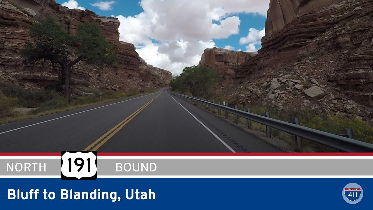
Take a high-desert drive through the canyonlands of southeastern Utah as we follow U.S. Route 191 from Bluff to Blanding. This 26-mile journey carries us northward from the sandstone cliffs and cottonwood-lined washes of the San Juan River valley into the upland plateaus of the Colorado Plateau—passing Indigenous lands, wide-open vistas, and the subtle signs of shifting elevation as we climb toward the edge of the Abajo Mountains.
Our route begins in the small town of Bluff, nestled beside the San Juan River, where U.S. 191 intersects the eastern end of U.S. Highway 163. The dusty red-rock surroundings of Bluff give off an unmistakable charm—one part old frontier, one part Navajo heritage center, and all surrounded by sculpted cliffs. Rather than continuing east towards Colorado, we swing north at the intersection with UT-162, beginning our climb out of the river valley. The land opens up almost immediately. Gone are the dramatic walls of the canyon; in their place, we find vast sagebrush flats under an ever-broadening sky. The road itself is smooth and well-maintained, with just enough curvature to keep things interesting.
As we continue northward, the scenery begins to shift gradually—subtle at first, but noticeable. The flat-topped mesas rise taller, and pinion-juniper woodlands begin to dot the horizon. About halfway through our journey, we arrive at White Mesa, a small Ute Mountain Ute community. The intersection with UT-262 marks a quiet but important crossroad—this eastbound spur leads toward Montezuma Creek and Navajo Nation lands. White Mesa itself is home to a uranium processing facility, which sits just west of the highway and stands in stark contrast to the otherwise timeless desert surroundings. It’s a reminder of the region’s complex relationship with energy, environment, and tribal sovereignty.
Leaving White Mesa behind, the elevation continues to rise gently as we make our way toward Blanding. Rolling hills and scattered pines begin to replace the flat scrubland. Just before reaching town, we pass the Blanding Municipal Airport and intersect with UT-95, which heads west toward Natural Bridges National Monument and Lake Powell. Here, U.S. 191 begins to show more signs of civilization—side roads, a few businesses, and the presence of local traffic. We end our route as the highway bends right onto Center Street in the heart of Blanding’s modest downtown. Despite its size, Blanding serves as an important gateway for travelers headed into the Canyonlands, Bears Ears, and beyond.
This drive, while short, encapsulates a quintessential Utah experience: sparse but stunning landscapes, Native heritage, and a road that stitches it all together with quiet dignity. From river valley to upland plateau, U.S. 191 from Bluff to Blanding offers a glimpse of both timeless desert beauty and the quiet pulse of life in the Four Corners region.
🗺️ Route Map
0 Comments